Day 74 Halifax NS 35 nm today 1637 nm to date

Image may contain: ocean, sky, outdoor, water and nature
Ramble On departs Jeddore
Image may contain: ocean, sky, outdoor, water and nature
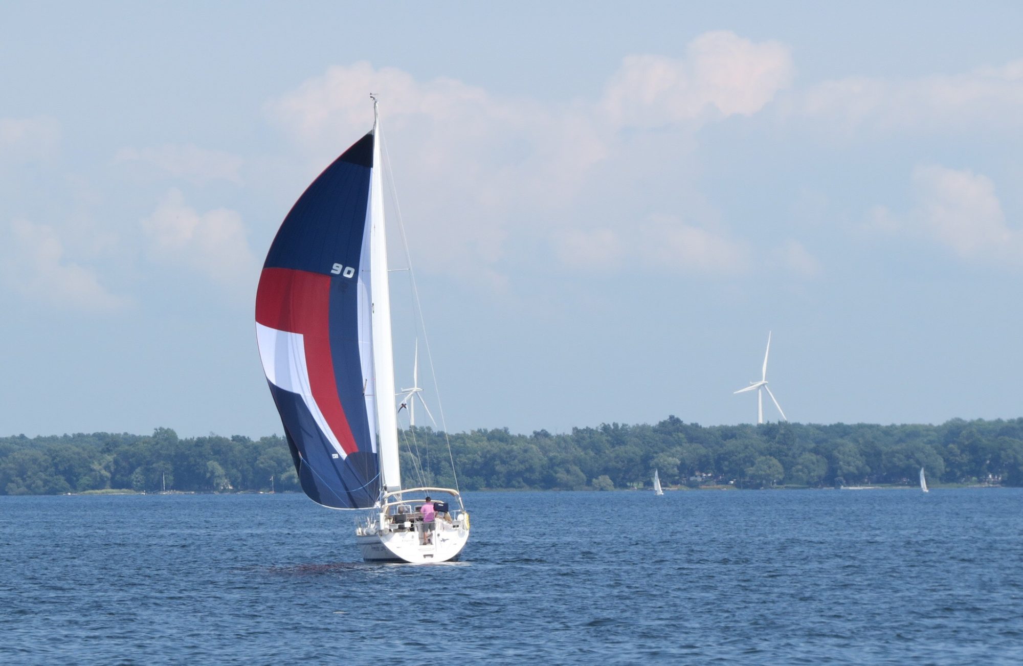
Nice picture of Ramble On about 500’ away

Woke up to …. surprise! Fog. Well not dense fog more of a shroudie fog that had mostly cleared by the time we departed at 8am. However, once we were back out in the Atlantic it was as thick as ever. Occasionally it would lighten so we could see each other at 1/4 a mile away but that was rare. Finnish Line 2.0 has radar so Ramble On was in charge of navigation while Finnish Line 2.0 rode radar shotgun. Kept Ramble On abreast on port side and did see two boats appear near them. The first I suggested they slow and alter course. The second was just a heads up as a boat was coming their way but along a parallel course. Some time later I saw a pink dot on the radar off my starboard bow 1/2 mile away. It seemed erratic and heading my way. I slowed and radioed Ramble On that I was altering course to cross their stern. Shortly after got a call on the radio for Finnish Line (thank you AIS) asking me if I could see him. I replied that I could see him on radar and he said he was behind me. I looked around and there was a mid-sized fishing boat 50th off my stern! Yikes! After that I figured out how to attach movement vectors to radar targets!

Once we got to the main Halifax buoy magically the far shore appeared and the remainder of the fog quickly lifted for our entrance into Halifax. We headed up the Northwest Arm to the Armdale YC. A wonderfully friendly club in a very pretty setting. It was a British military prison setup in 1802. US War of 1812 prisoners were held here as were WW II German naval prisoners. The clubhouse sits on a high bank with the docks in a circle around the island. The dining room and patio offer a very beautiful view across the docked and moored boats to the treed shore of Halifax proper.

Image may contain: ocean, sky, outdoor, water and nature
We’ve made it to Halifax !!
Image may contain: cloud, sky, outdoor, water and nature
Armdale YC
Image may contain: sky, cloud, ocean, outdoor, nature and water
The view from the clubhouse

Day 73 Myers Pt Jeddore River NS 25 nm today 1601 nm to date

Image may contain: ocean, sky, outdoor, nature and water
Wow. Nice to see land.

Left Shelter Cove about 11 in more fog than when we came in. It’s supposed to be a very pretty anchorage but we’ll never know. Today’s motor was much like yesterday without the big swells. However, when we reached the mouth of the Jeddore River it slowly began to clear. We did not like the anchorage as recommended in Active Captain so we continued up river and found a very nice and, yes, pretty anchorage. However, just after we anchored we could see the fog rolling up the river at us. Hopefully it dissipates and we can have dinner in the cockpit.

btw, we do not know if the name of this river is Jeddore. No name on charts nor google maps so we named it after the town.

Image may contain: ocean, sky, outdoor, water and nature
Jeddore looks like a good fishing port
Image may contain: ocean, sky, outdoor, water and nature
Pretty anchorage facing SW


Image may contain: ocean, sky, outdoor, water and nature
and facing west
Image may contain: ocean, sky, outdoor, nature and water
fog begins to roll in …. very tiresome

Day 72 Shelter Cove NS 24 nm today 1577 nm to date

Foggy, foggy day. We could not see the island behind us 1/10 of a mile away so decided to wait for it to clear. This occurred about 11:30 so by noon we were off in wonderful sunshine. Except it didn’t last. The fog returned and was very thick. Although the two boats maintained a position of about 400’ of separation they often could not see each other. Most of the 22nm route was wending our way around small islands and shoals. Thank goodness for radar and AIS!! Worst part was having to wipe the mist off my glasses every 45-60 seconds to be able to see the chart plotter …. most annoying.

Image may contain: ocean, sky, outdoor, water and nature
The last vestiges of fog as we set off. Or so we thought.
Image may contain: ocean, sky, outdoor, water and nature
Finnish Line 2.0 as seen from Ramble On

Shelter Cove has an inner spot but according to the charts the entrance was only 3’ and we draw 4.5’. But it was almost high tide so Finnish Line 2.0 slowly entered but never saw less than 27’ in the entrance. Could make out another anchored boat tucked in at the top of the cove but soon it was lost in the fog. We anchored in 22’ and enjoyed watching a seal play with its dinner.


Image may contain: ocean, sky, outdoor, water and nature
A photo of the other boat in our anchorage


Day 70 Hartlings Island NS 47 nm today 1533 nm to date

A sunny and much calmer day. It was a few miles longer than yesterday but we made much better time with few swells. Unfortunately it was all motor sailing but que sera sera. About an hour after departing I had a call from Ramble On to say look out for wildlife. Minutes later I felt the boat take a bump and looking behind I had a quick view of a fin. A fin of what we don’t know but I seriously believe it was Moby Dick (and I’m stickin’ to that!).

Thanks to GPS and our plotters were were able to stick closer to shore and weave and bob through the small shoals and rocks. As there were no white caps it was very easy to see the shoals!

Arrived at our anchorage about 3:30. We are on the north east side of Hartlings Island and nicely tucked in and will stay here tomorrow to relax and avoid some higher winds outside.

Time-wise this marks our halfway point although mileage-wise we’ve done about 55% at over 1550 nm under our keels to date.

Image may contain: ocean, sky, outdoor, water and nature
Ramble On works its way through the rocks,shoals and small islands as we make it closer to our anchorage.
Image may contain: ocean, sky, outdoor, water and nature
One of the shoals 150’ off to starboard .. the rock is clearly visible. Very pretty though.


Day 69 Tor Bay NS 46 nm today 1506 nm to date

Caught the first lock through the No photo description available.St Peters Canal. As I’m solo I had to manage the boat with only a single line amidships. Luckily almost no wind so it was a pretty timid affair. Lovely sunny day and it felt good to be underway on our voyage again. BUT the swells were creating a washing machine effect and the winds were right on our nose. Partway across Chedabucto Bay (between Madame Isle and Canso) Ramble On had some engine problems and had to stop. After some inspection they were able to carry on but did so for awhile at lower rpms just to be sure. After rounding Canso we were able to motor sail and even sail w/o the engine for awhile. Lots of rolling creates tired sailors so we were happy to pull into Tor Bay just before 6pm and be protected from both the SW winds and swells.

Image may contain: ocean, sky, outdoor, water and nature
Bumping by lighthouse near Canso into open ocean
Image may contain: ocean, sky, outdoor, nature and water
Our quiet anchorage sans winds and swells


Image may contain: sky, tree, outdoor, nature and water
a large boulder just lying around. Doubt if it’s an erratic

Day 68 St Peters NS 29 nm today 1460 nm to date

A nondescript motor back to St Peters while Tarja drove Ben to the Sydney airport for his flight home. In St Peters got fuelled up and water tanks filled for our jaunt down the south coast of Nova Scotia to Halifax. Final dinner with Tarja (she returns to Kingston tomorrow) at the Bras d’Or Lakes Inn. Usually one hears of Cape Breton folks moving out west. Our waitress from BC has settled on Cape Breton. From one beauty spot to another.

Image may contain: sky, house, cloud and outdoor


Day 67 Louisbourg NS

It was a warm and sunny day for our visit to Louisbourg. We got there shortly after 10 and left around 4:30. It was well worth the visit. We did tours that gave a lot of background on the reconstruction of the fort. We were surprised to find out that much of construction work was done by retrained coal miners who lost their jobs when the mines closed. In fact, one of the reasons for federal funding of the reconstruction was to provide those jobs. Ben signed up to fire a cannon and we had lunch 1700s style, pewter dishes and a spoon was the only cutlery we could use. We finished the day with dinner on the water in Sydney.

Image may contain: sky, house, grass, cloud, outdoor and nature

Image may contain: sky, grass, outdoor and nature


Image may contain: people sitting, table and indoor
Making lace
Image may contain: plant and outdoor
Baaaaaa


Image may contain: sky, outdoor and nature


Image may contain: 1 person, smiling, standing and hat
Ben getting ready to march
Image may contain: one or more people, grass and outdoor
Ben’s march to glory


Image may contain: grass, outdoor and nature
boom !!
Image may contain: 2 people, people smiling, beard, hat and outdoor
It’s all over, Ben with a fellow volunteer


Image may contain: cloud, sky and outdoor

Image may contain: sky, ocean, outdoor, nature and water
The fortress laid out. Only about 1/3 of it has been restored and one still needs a day+ to see it all
Image may contain: outdoor
An interesting sign by our Sydney restaurant.


Day 66 Ben Eoin Bras d’Or Lakes NS 28 nm today 1432 nm to date

Image may contain: 2 people
Pre dinner drinks on the balcony last night.

After breakfast on the balcony facing the water that we shared, we started the drive back to Baddeck. Two more stops at craft shops. Bob and

Image may contain: 1 person, smiling, sitting and outdoor
Morning coffee on our shared balcony.

Tarja picked up a gorgeous glass bowl that turned out to be made by a Finnish artist who had moved to the Cape three years ago. She was doing a glass blowing demo on site so Tarja got to practice her Finnish, the artist told her Cape Breton had captured her heart. At the leather shop Peter and Ze got the leather bucket, yes leather bucket, that Peter had been eyeing for a while.

We said a big thank you and fond farewell to Peter and Ze who were driving back to the Halifax area for Ze’s niece’s wedding and the boats left for Bon Eoin on the eastern arm of Bras d’Or lake. The boats and Tarja met up at the Bon Eoin Yacht Club and Marina around 5, Tom and Sue on Dragon III arrived an hour later and Rick & Laura (from KYC) who are doing a driving holiday on the east coast and staying at a campground near us arrived around 7. It was a great KYC reunion.

Image may contain: sky, cloud, tree, outdoor, nature and water
Balcony view
Image may contain: people sitting, ocean, sky, outdoor and water
Ben Eoin YC


Day 65 Cape Breton Road Trip cont’d

Image may contain: sky and outdoor
Cabot’s Landing

The forecast for today was not great but mostly it was very light rain on and off which didn’t deter us at all. Ze took us to several lovely little fishing villages on the east side of the Cape, which we would not have known about if we had been touring on our own. We also stopped at several craft shops, Bob and Tarja were able to resist the $1,000 quilt. Our final tour stop was a hike that started at the Keltic Lodge and went along a narrowing piece of wooded land ending at a point. It was an up and down hike in very pretty woods with lots of wet tree roots from last night and today’s rain. Luckily by the time we started the hike, the rain had stopped. After dinner at a nearby restaurant recommended by the owner of the Driftwood where we stayed that night, we drove to the Keltic Lodge and stayed for about an hour to hear a wonderful local singer and fiddler.

Image may contain: sky, cloud, mountain, tree, outdoor, nature and water
Dingwall
Image may contain: sky, ocean, cloud, outdoor, water and nature
White Point fishing village


Image may contain: sky, house, tree, grass, plant, cloud, outdoor and nature
St Paul’s Lighthouse (relocated)


Image may contain: sky, plant, ocean, mountain, tree, outdoor, nature and water
Beautiful views everywhere
Image may contain: sky, plant, tree, outdoor, nature and water
White Point or Black Brook


Image may contain: one or more people, people standing, ocean, sky, outdoor, nature and water


Image may contain: one or more people, tree, plant, outdoor and nature
Starting the hike at the Keltic Lodge


Image may contain: tree, plant, outdoor and nature
Lots and lots of tree roots


Image may contain: plant, tree, outdoor and nature

Image may contain: ocean, plant, sky, outdoor, nature and water
In 1900 there was a fishing village here
Image may contain: one or more people, people standing, sky, tree, outdoor and nature
At the end of the trail


Image may contain: 1 person
Singer and fiddler at Keltic Lodge