Awoke to fog which cleared and we had a fun sail tacking down Penobscot Bay arriving just after 2:30 in Camden. We followed several large, old schooners in through the biggest mooring field we’d ever seen-could only capture 1/2 of it on camera. The small harbour at the end uses floating dock islands rather than mooring balls to be able accommodate more boats (floating docks don’t swing with wind and current changes). We tied up at the town dock and enjoyed our walk around town — it’s a lovely old town with a real vibe.
This is only half the mooring field !Floating docks
A pleasant sunny morning with little wind as we motored the 10 nm to Belfast. Studied the spots where the British ships lined up against the American invaders in the 1799 battle and also where the US fleet was destroyed in the Penobscot River. This river was also the setting in the movie, “Red October”, where Sean Connery takes the Russian sub.
Arrived about noon and spent the afternoon visiting the history museum and looking around town.
Still on our mooring in CastineMouth of the Penobscot RiverDowntown Belfast
A cool morning today waking up to 14C. But it warmed up nicely and was a beautiful sunny day. Unhappily due to low wind speeds and often being on our nose it was a full motoring day. The usual crab pots along the way but hardly any at all as we neared Castine. We think it’s because the Maine Maritime Academy is here with it’s 500’ 160,000 ton training ship that plies these waters and doesn’t dodge crab pots!
Many islands with small fishing inlet villagesThe two mooring balls on the left are for visitors
A real estate broker with its own building for sale. Not this guy’s a capitalist
About mid afternoon we fetched mooring balls at the yacht club and dinghied ashore to pay and then explore the town. The town is older than the settlement at Plymouth Rock by 7 years ergo 1613. It is a fine example of 1700s style housing many of which survive today. However, not all or st least not here. Some houses were built prior to the American Revolution and when the Loyalists departed after 1783 some took their houses with them. There is a vacant lot on Main Street that speaks to this, they all went to St Andrews New Brunswick.
We got directions to the History Center from a very kind, elderly woman. I read within the last few years Bernard Cornwell’s, “The Fort”, about the American army and navy from Massachusetts trying to take the British fort, The George, in 1779. I had some notion that it was near Castine but I discovered at the museum that the fort and battle were only a few blocks away. So we walked over to see it. Nothing like seeing the real thing to bring it alive. So our boats are where the British ships would’ve lined up to defend against the Americans. Unfortunately for the American forces no one was in charge so the whole operation ended badly. It’s been listed as the worst US naval disaster until Pearl Harbor.
Fort George
This pub designer had a sense of humourThe Castine mooring field … Ramble On and Finnish Line 2.0 are on the right on the outside
Our only shot of Burnt Coat Harbor due to our hasty exit
The morning was a leisurely breakfast before we agreed that about 9:30 we’d all dinghy ashore to check out the village and shops. As we all came on deck we saw that things didn’t look right. We had dragged our anchor back in a straight line back 150’ and were now just 20’ off a fishing trawler. Lots of scrambling to cast off Ramble On while we tried to stop the dragging, and recover the anchor. The wind was piping up so this was a bit more challenging and as the anchor came up it snagged a pot. After wrestling with it using a boat hook Chris realized the answer was to let down the anchor and then take it up again. That worked so we tried to anchor again and again we dragged right away. Why it held all night but not now isn’t clear. We read later that it was a very weedy, soft muddy bottom so maybe that along with the extra wind coming in caused this. We decided to call it quits and set off for that night’s anchorage.
Another day of lazy sailing and crab pots. Just before our island I noticed a crab pot ahead in my path out of line with some of the others. When I got up to it, it was a seal with its nose in the air apparently sleeping. Half a boat length away he woke up and dove away.
A field of crab pots —- no straight line sailing hereThe entrance to Seal Harbor
We arrived about mid afternoon and decided against the first anchorage in this long winding harbour and instead go the mile and a half to the one at the end. This is a well known beautiful spot so there were several other boats on the way as well as at the end. But there was room for us so we relaxed and enjoyed the beautiful rocky, treed surroundings.
Other than the crab pots it was a pretty easy, sunny day with half of it under main only kinda drifting along like real cruisers. With low tide approaching the narrow channel entrance was a bit of a cautious entrance into the harbour—we kinda came in through the side door. Took a long time to find a good anchorage spot so we didn’t hit any crab pots, nor fishing boats nor run aground …. one of most challenging so far this trip. We got it done but then didn’t like so we got it done again. As usual Ramble On rafted from us so we enjoyed cocktail hour and a good dinner. Dinner was below despite the beautiful view of the fishing village but cold and mosquitos do that to one. Sadly there are no photos of the village but you’ll have to read tomorrow’s entry to find out why.
This is a very beautiful harbour surrounded by high treed hills. There’s obviously a lot of money here. Hinckley Yachts are built here and there are many of them here. A 35’ beside Ramble On is a ‘picnic’ boat so really a day boat runabout. New this boat (pictured below) would cost about a million USD!
The town was pretty but high end and generally folks here aren’t that friendly or maybe we just got used to the friendliest of Nova Scotians.
Packages awaiting the ferryThe ferry takes on packages and passengers
The small ferry that serves the small islands comes into the dock beside us. When we are arrived we saw a UPS truck dropping off many boxes. When the ferry arrived they placed al the boxes on the roof before taking on their passengers. A very well used service.
There are very frequent shuttle buses here that are free and sponsored by LL Bean – great service and keeps a lot of cars off the road. It took us about 2 hours to take 2 different shuttles to the airport for Debbie to pick up her car (she’s driving home to Canada) and pick up Chris McDonnell who was flying in from NYC to crew on Finnish Line.
35’ Hinckley ‘picnic’ boatWhat a million USD gets ya
Cable Sable lighthouse at 101’Sunrise!Finnish Line 2.0 sails into the sunrise
Leaving just before noon we set off for our overnight to Maine. After almost 28 hours and 166 nm we arrived in Maine. The weather was good for the whole trip, waves were not big but wind was light too. It was warm going down the 9 mile Shelburne Harbour but the winds off the Atlantic greeted us with the big chill requiring many more layers of clothes put on. It was a little bit bouncy as we headed SW to pick up Brazil Rock to take the outside route around Cape Sable. After rounding Cape Sable we set a course NW to pass between Seal and Mud Islands. Passing through these islands at the wrong tide can leave one with strong currents. We passed through about 9:30pm ADT in the dark. However, a large fishing trawler nearby w/o lights caused a bit of concern when it turned up on our radar. After connecting by radio he agreed to put on all lights until we were passed. The moonrise at 11:30pm ADT was a spectacular blood red ball appearing over the horizon off our sterns. During the night the engine seemed tougher and was producing more white smoke. Stopped the boat, put it in reverse for a few minutes and the problem disappeared which meant there was something caught on the prop. In the morning we had overheating incidents. The first was fixed by cleaning the raw water intake strainer which had been cleaned before we left but there was much plant life floating around. The second involved tweeting the impeller which didn’t make any sense but it worked.
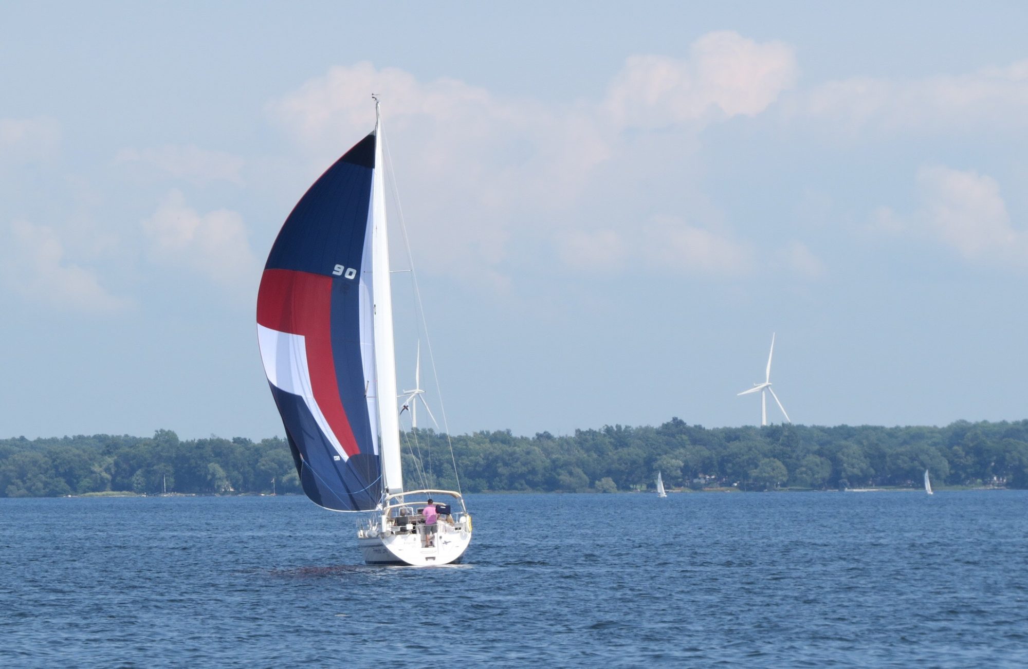
Maine is infamous for the number of crab pots along its coast. We sighted our first line of pots 40 nm out in 700’ of water. However, it was a one-off and we saw no more for another 15 nm. Unfortunately we attracted fog before that so it became quite the challenge watching both the radar and and the water. Approaching land about 2pm ADT we thought the pots weren’t that bad. BUT entering the waterway amongst the islands the density of the pots grew dramatically as did the other boat traffic. It was impossible to steer a straight course and was quite a challenge to find any course at all. Fortunately the final run up to our harbour was mostly pot free.
When we were about 5 nm out we tucked up into pots and used the US’s border patrol app, ROAM to check in. We submitted our info and there was no invitation to video conference. Instead we rec’d a phone call to say we were checked and, to our delight, they granted us a cruising permit. The CBP website says you need to have an officer in person at the boat to get one!
Assume we all got enough sleep when not on watch as we were able to return to our routine of cocktails followed by dinner at 7pm EDT.
Hanging in Shelburne waiting for a weather window to cross to Maine as we have to round Cape Sable and cross the Bay of Fundy. It’ll be a 26+ hour crossing. We’ll depart Tuesday mid-day.
Shelburne is a treat as an historic town. Sort of Lunenburg without the bustle. We toured the 3 museums: the dory factory, the town museum, and the Ross-Thompson House.
The Dory Museum. Schooners would pull up to the water side door to pick up their dories
I have wonderful memories of visiting the dory factory from our family trip here in 1993. They used to turn out 2 dories a day – over 50,000 were built since 1880. Now they build 1 or 2 a year. The Ross-Thompson House had a wonderful tour guide in period costume who took us all through the house. It was a rich merchants’ house built in 1783. Later it was left vacant for 40 years before being bought by a Harvard professor. Almost all the original furnishings and other household pieces were still there making it a real find as a museum.
The town was very tarted up for the filming of the movie, “The Scarlet Letter”, in the mid-90s which has stood it in good stead as an historic town. Many seasonal residents, mostly American, have furthered restored houses they’ve bought up in town. The town’s streets are a charm to wander. Before declining in the 1790s the town had a population of 10,000 far from its current 1,800.
Ross-Thompson House – part warehouse, part shop, part residence
The large dark barrel was built in the 1760s in Portugal
The thicker appearing plate could be filled with hot water and a plate with food on it could be kept warm by setting on top while delivering to the table
Dock StreetA saw mill with all its saws and other machinery cries out to be renovated and opened
Pleasant homes …
…. pleasant streets
Every Monday at pm there’s a music jam in the garden of the Ross-Thompson House Museum. The woman in white is playing a hurdie gurdie.
This afternoon we attended the music session held each Monday at 1pm in the garden of the Ross-Thompson House. The main chap (a retired school music teacher) in period costume is meant to play baroque but locals turn up with their instruments so he’ll go wherever the group goes. Many are professional musicians from the US who in their travels discovered Shelburne, bought a house and spend 6 months a year here. One woman was playing her hurdie gurdie.
Off again in a fog bank. Our usual routine: Ramble On leads and does the navigation. Finnish Line 2.0 is close behind with a split screen showing the charts with its position plus the position of Ramble On via AIS. The other window has the radar for two miles out to identify marks out of place and/or other boats near by and if found inform Ramble On as to where. Has worked rather well as we’ve made it this far w/o a collision. Today we went through the .3 mile gap on the north side of Ram Island and couldn’t see either land. Once through I looked up from the radar screen to see a fogless view of the land I was steering at. Wow, very jarring. Not that it was close but when you’re not used to seeing anything …. Fog, of course, came back just as quickly. Thankfully it finally ended about 2pm so the last hour we got to enjoy the fine views of Nova Scotia.
The Shelburne YC building was gutted inside by fire this past May. They are operating out of a trailer for the season until it can be restored! Tough break.
Mouton so named because a sheep fell of Champlain’s ship here in 1604.
The black in the lower left is a large safe built in GALT ON in 1880s and still in use
Woke up to fog and went to the bakery for a delicious breakfast.
Front of the bakeryFog lifting ….. or not
After 10am the fog was clearing so off we went only to be met by very thick fog near the river’s mouth. Thank goodness for AIS and radar as we came near several boats moving in the opposite direction to us, several very close. Visibility was less than 2 boat lengths. The visibility increased to a 1/4 mile in the afternoon and finally clearing mid-afternoon.
We passed West Berlin and East Berlin (don’t ask me I have no idea), Coffin Island and near our anchorage Massacre Island.
By this time 4:30 or so the fog had returned. We carefully felt our way through shoals, rocks and small islands. This would have ended badly without a chart plotter and radar: don’t try this at home w/o them. Luckily the visibility increased to about 100 yards once we entered the cove and dropped the anchor.


 professor. Almost all the original furnishings and other household pieces were still there making it a real find as a museum.
 The town was very tarted up for the filming of the movie, “The Scarlet Letter”, in the mid-90s which has stood it in good stead as an historic town. Many seasonal residents, mostly American, have furthered restored houses they’ve bought up in town. The town’s streets are a charm to wander. Before declining in the 1790s the town had a population of 10,000 far from its current 1,800.


 bakery for a delicious breakfast.
